We have at last got the election done for the new seven wonders nature on 11/11/11. Among the 15 finalists Amazon, Halong Bay, Iguazu Falls, Jeju Island, Komodo, Puerto Princesa Underground River, and Table Mountain are the last seven which come out as winner. The last 15 finalists were Amazon: South America, Angel Falls: Venezuela, Bay of Fundy: Canada, Black Forest: Germany, Bu Tinah Island: United Arab Emirates, Cliffs of Moher: Ireland, Dead Sea: Israel, Jordan, Palestine, El Yunque: Puerto Rico, Galapagos: Ecuador, Grand Canyon: USA, Great Barrier Reef: Australia, PNG, Halong Bay: Viet Nam, Iguazu Falls: Argentina, Brazil, Jeita Grotto: Lebanon, Jeju Island: Korea (south), Kilimanjaro: Tanzania, Komodo: Indonesia, Islands of the Maldives: Maldives, Masurian Lake District: Poland, Matterhorn/Cervino: Italy, Switzerland, Milford Sound: New Zealand, Mud Volcanoes: Azerbaijan, PP Underground River: Philippines,Sundarbans: Bangladesh, India, Table Mountain: South Africa, Uluru: Australia, Vesuvius: Italy, Yushan: Chinese Taipei.
Komodo Islan, Indonesia, is at fifth in order of choice.
what and where is it?
Komodo is one of the 17,508 islands that make up the Republic of Indonesia. The island has a surface area of 390 km² and over 2000 inhabitants. The inhabitants of the island are descendants of former convicts who were exiled to the island and who have mixed themselves with the Bugis from Sulawesi. The population are primarily adherents of Islam but there are also Christian and Hindu minorities. Komodo is part of the Lesser Sunda chain of islands and forms part of the Komodo National Park. Particularly notable here is the native Komodo dragon. In addition, the island is a popular destination for diving. Administratively, it is part of the East Nusa Tenggara province.
Komodo lies between the substantially larger neighboring islands Sumbawa to the west and Flores to the east. It's geographical location is 8.55°S 119.45°E.
History:
The earliest stories of a dragon existing in the region circulated widely and attracted considerable attention. But no one visited the island to check the story until official interest was sparked in the early 1910s by stories from Dutch sailors based in Flores about a mysterious creature. The creature was allegedly a "dragon" which inhabited a small island in the Lesser Sunda Islands (the main island of which is Flores in East Nusa Tenggara). The creature is called Komodo dragon after the name of the island.
How to get there:
Indonesia is a multi-cultural, multi-ethnic society of about 229 million people spread out over almost 2 million square kilometers west to east right on the equator in South East Asia. Neighbouring countries are Malaysia, Singapore and the Phillipines in the north, Papua New Guinea in the far east (sharing the border with West Papua, the former Irian Jaya), and Australia and East Timor in the south. Local time varies from GMT (Greenwich Mean Time) +7 in Java to GMT +9 in West Papua. Indonesian Rupiah (IDR) is the official currency in Indonesia. Most resorts and larger restaurants accept international credit cards, though usually only in the main tourist hubs.
Many international airlines fly nonstop to Indonesia's main airports in Jakarta and Denpasar/Bali, and many Asian carriers also connect the smaller island airports directly from Singapore or Kuala Lumpur as well. The national carrier is Garuda Indonesia. They compete for Indonesia-bound passengers mainly with Singapore Airlines, Qantas, Thai Airways, Cathay Pacific, Emirates, Qatar Airways and Korean Air.
More small domestic carriers offer online schedules these days, but many can still only be ticketed by operators and agents within Indonesia. Among the low budget carriers whose tickets can only be instantly purchased online, Air Asia offers the most frequent and covenient schedules from a variety of Asian cities. Sorong Airport, the gateway to Raya Ampat is one of the most difficult places to reach. Lion Air, Merpati, Xpress Air and Batavia Air offer regular schedules from Jakarta/Makassar, Manado and Ambon. Balikpapan in Kalimantan is serviced by Lion Air and Mandala Airways among others. For Komodo liveaboard cruises, flights between Labuan Bajo or Bima originate in Bali and are usually part of your cruise arrangements.
Safety:
Indonesia is a multi-cultural, multi-ethnic society of about 80 million people. There are more than 300 different indigenous languages spoken throughout this vast archipelago, and apart from certain aspects of centralised bureaucracy based in Jakarta/Java, many islands have little else in common with each other. While Indonesia is a predominantly Muslim nation, dive tourism operators seem to cluster in non-Muslim areas, for example in North Sulawesi, which is mostly Christian, Bali, or the very sparsely populated island regions around Eastern Indonesia or Kalimantan (Indonesian Borneo).
In Bali, almost all families are Hindu, which makes their collective character, behaviour and way of life vastly different from Muslim Indonesia. The Balinese practice a unique version of Hinduism which emerged from a blend of Indian Hinduism, Buddhism and indigenous animist beliefs. Regrettably, in the past decade Bali has been the chosen target of terrorist activities imported from other islands, because most of the Indonesian tourism is centred there. This means that the densely populated southern beaches around the island capital Kuta could not be considered completely 100% safe, just like many other international holiday hot spots worldwide. However, there are no safety issues in the countryside, particularly around the very remote Northern coastline. The Balinese have always been the most peaceful, friendly and hospitable people imaginable.
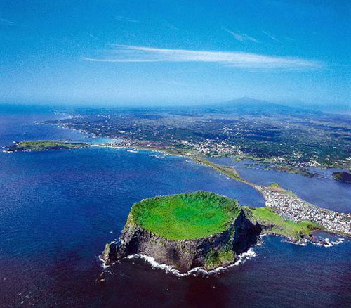
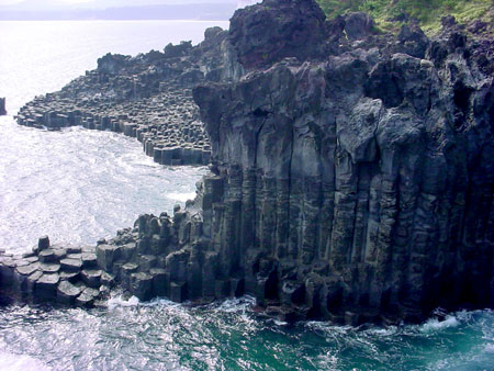
Images that give you a thorough idea what this island looks like: