We have at last got the election done for the new seven wonders nature on 11/11/11. Among the 15 finalists Amazon, Halong Bay, Iguazu Falls, Jeju Island, Komodo, Puerto Princesa Underground River, and Table Mountain are the last seven which come out as winner. Jeju Island placed fourth in the order of New Seven Wonders Nature. Jeju-do, the original name of Jeju Island is the only special autonomous province of South Korea, situated on and coterminous with the country's largest island. Jeju-do lies in the Korea Strait, southwest of Jeollanam-do Province, of which it was a part before it became a separate province in 1946. Its capital is the city of Jeju. The island contains the Natural World Heritage Site Jeju Volcanic Island and Lava Tubes.
History:
In Korean, do is the phonetic trancription of two distinct hanja (Chinese characters) meaning "island" and "province". However, Jejudo generally refers to the island, while Jeju-do refers to the government administrative unit. The table below also includes the name of Jeju City, the provincial capital. According to legend, three demi-gods emerged from Samsung-hyeol which is said to have been on the northern slopes of Mt. Halla and became the progenitors of the Jeju people who founded the Kingdom of Tamna. It has also been claimed that three brothers including Ko-hu who were the 15th descendants of Koulla, one of the Progenitors of the Jeju people, were received by the court of Silla at which time the name Tamna was officially recognized, while the official government posts of Commander, Prince and Governor were conferred by the court upon the three.
In modern times there was uprising there which is called Jeju uprising of 1948. The Jeju Uprising, which began on April 3, 1948, was part of a larger problem across Korea at this time. The rebellions on Jeju-do, which resulted in the deaths of hundreds of officials, armed organizations, and villagers alike culminated in widespread violence on the island and the center of the island (Halla Mountain) being listed as an "enemy zone" by the government of the Republic of Korea. Over 30,000 people were killed as some villagers and communist radicals alike were imprisoned in internment camps under the policies of mainland government.
The provincial administrative building was burned to the ground in September 1948 and a new building was completed in 1-do, 2-dong in December, 1952. Until 2005, Jeju Province was divided into two cities (si), Jeju and Seogwipo, and two counties (gun), Bukjeju (North Jeju) and Namjeju (South Jeju) respectively. The two cities were further divided into thirty-one neighbourhoods (dong), while the two counties were divided into seven towns (eup) and five districts (myeon). The seven towns and five districts were in turn divided into 551 villages (ri). In 2005, Jeju residents approved, by referendum, a proposal to merge Bukjeju County into Jeju City, and Namjeju County into Seogwipo City. Effective 1 July 2006, the province was also renamed Jeju Special Autonomous Province with two nominal subdivisions, Jeju and Seogwipo city. In addition to changes in name, the province has been given extensive administrative power that has been reserved for the central government. This is part of plans to turn Jeju into a "Free International City". Jeju, on 1 July 2006, was made into the first and only special autonomous province of South Korea.
The Geographical position:
Jeju Island is a volcanic island, dominated by Halla-san (Halla Mountain): a volcano 1,950 metres (6,400 ft) high and the highest mountain in South Korea. The island measures approximately 175 kilometres (109 mi) across, end to end, at the widest points. The island was created entirely from volcanic eruptions approximately 2 million years ago, during the time period from the Tertiary to the beginning of the Quaternary period, and consists chiefly of basalt and lava. The eruptions took place in the Cenozoic era. It has a humid subtropical climate, warmer than that of the rest of Korea, with four distinct seasons. Winters are cool and dry while summers are hot, humid, and sometimes rainy. There is a crater lake which is the only crater lake in South Korea. An area covering about 12% (224 square kilometres or 86 square miles) of Jeju is known as Gotjawal Forest. This area had remained untouched until the 21st century, as its base of ʻAʻā lava made it difficult to develop for agriculture. Because this forest remained untouched for a long time, it has a unique ecology. The forest is the main source of groundwater, the main water source for the half millon people of the island, because rainwater penetrates directly into the groundwater aquifer through the cracks of the ʻAʻā lava under the forest. Gotjawal forest is considered an internationally important wetland under the Ramsar Convention by some researchers because it is the habitat of unique species of plants and is the main source of water for the residents, although to date it has not been declared a Ramsar site.
Have a look to the wonders of nature:
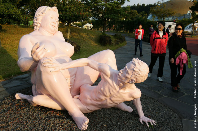
Jeju Island also called the "Island of Love"


No comments:
Post a Comment